What Each Color Means On Nautical Charts (Don’t Run AGROUND!!)
- By: Tony Acevedo
- on
- Found In: Fishing Tips, WEEKLY NEWSLETTER: 10-11-20
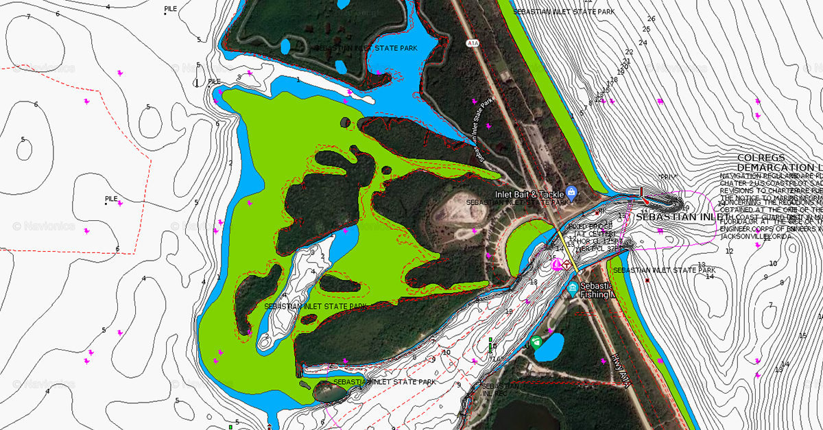
Do you know what blue, green, and white colors mean on nautical charts?
If you don’t, you could risk running aground or missing out on finding good fishing spots.
So in this video, I’ll show you what each of these colors means, plus how knowing them can help you catch fish.
Let’s dive in!
What Each Color Means On Nautical Charts [VIDEO]

Mentioned links:
Here’s what each color means on nautical charts:
White
White means that the area is deeper water that you can typically navigate your boat through on normal tide levels.
Blue
Areas in blue mean that on a normal low tide, there will probably be water in the area, but it’ll most likely be less than a foot.
These are typically flats that you can find fish on during high tide, and fish near the edges during low tide.
Green
Areas in green have water covering them at high tide, but will be exposed during low tide.
Obviously, you’ll want to be very careful around these areas when driving your boat nearby.
These are typically sandbars, shallow islands, or even oyster bars.
Conclusion
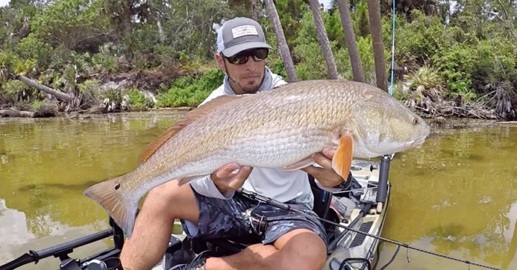
Knowing how nautical charts are color-coded can help you avoid running aground and find good fishing spots.
White signifies deeper water, blue signifies shallower water, and green shows areas that are sometimes exposed on low tide.
Have any questions about reading nautical charts?
Let me know down in the comments.
And if you know someone who needs to learn what these colors mean, please TAG or SHARE this with them!
P.S. Want access to our best fishing spots and tips, plus discounts to our online tackle store? Click here to join us in the Insider Club!
Related articles:
Related categories:
STOP WASTING TIME ON THE WATER!
Do what the “SMART ANGLERS” are doing and join the Insider Club.
Here’s what you’ll receive today when you join:
- Weekly fishing reports and TRENDS revealing exactly where you should fish every trip
- Weekly “spot dissection” videos that walk you through all the best spots in your area
- Exclusive fishing tips from the PROS you can’t find anywhere else
- Everything you need to start catching fish more consistently (regardless if you fish out of a boat, kayak, or land).


Awesome
Great info Tony and very helpful ! No matter how many times we look at charts, we can use a little coaching. Thanks.
Thank you for the great feedback Buddy!
You spoke of the white, blue and green areas. But what are the black areas? Not the black lines, but black areas?
Hey Richard!
Not to sure what you mean. Some areas the lines are very close together so it may look black if you are zoomed out (those are areas with steep/quick depth changes).
Great info Tony. One thing, for those using that Navionics cartography on a sounder, such as my Lowrance, you can add Depth Shading via the menu to the Navionics Plus base map.
For example, if you know, based on water temp, prior fishing or Intel from a fellow fishermen that fish like trout are holding in water at depths of 4-6′, then you can set the min/max depth to those levels and it will paint any area with that range a specific color. So if you need a Trout for a slam or the dinner table for example and you know they are holding in deeper pockets due to cooler or warmer water temps, you can light up the plotter with regions that are within that range.
For the Nature Coast in summer you tend to want a specific depth and healthy green grass and this helps narrow the myriad locations down.
Thank you for the great intel and tips Bill!
Would you be willing to check out the Stump Pass area and tell me what would be good spots? I’m on a boat. Thanks. You’re info is great.
Thanks. I was wondering about the little pink icons that are all over the chart as well. They look like little chickens to me. What do those icons signify?
Hey John!
Those represent a wildlife sanctuary and/or conservation area.
Thanks!