How To Find Inshore Fishing Structure The Quick & Easy Way
- By: Tony Acevedo
- on
- Found In: Fishing Tips, Inshore Fishing, Weekly Newsletter: 12-1-19
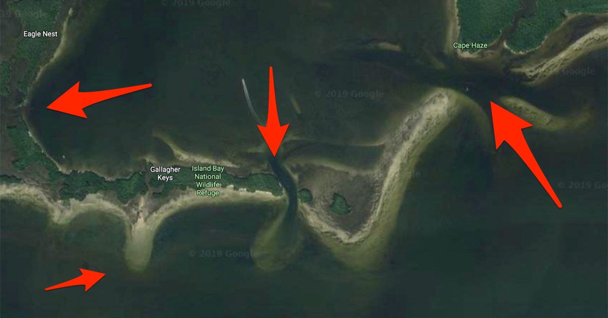
Everybody knows that fish like structure…
- Points
- Cuts
- Channels
- Oyster bars
- Seagrass
- Potholes
- Shoals
Those are just a few structure elements you can find fish on.
That’s the easy part…
The harder part is finding the structure.
How do you find a cut or a shoal in a place you’ve never been to?
Or how do you find an oyster bar if it’s underwater?
Yes, you can put in “time on the water,” but there’s a much quicker and easier way to find these elements.
Want to see how?
Check out this video.
How To Find Inshore Fishing Structure [VIDEO]

Below are a few examples of inshore fishing structure to look for and how to spot them on a map, as well as some definitions of common fishing terms.
You can use Google maps, but if you want to see the satellite map plus the sonar map, weather, tides, and fishing forecast, check out SmartFishingTides.com.
Sandy Potholes & Grass Flats
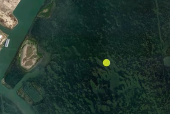
In the image above near the yellow dot, you can see that the darker green is the seagrass and the lighter areas are sandy potholes.
These places are ideal because seagrass can be home to baitfish, shrimp and crabs, and the grass and potholes give predator fish places to hide and ambush their food.
Cuts & Troughs
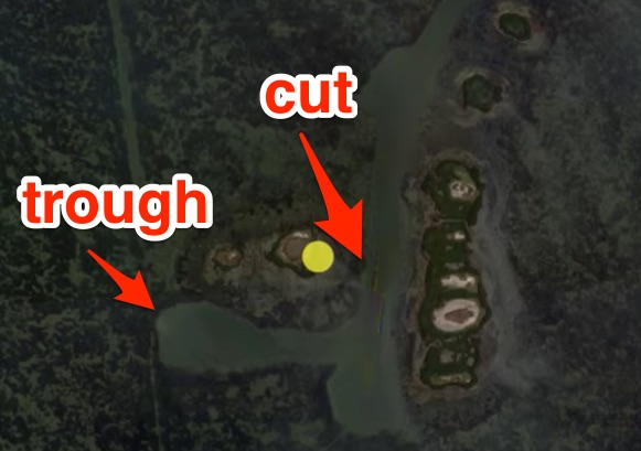
A cut is an area that “cuts” through two different pieces of structure.
Troughs are very similar, although I would consider a trough a section of deeper water that’s more out in the open.
Both of these areas provide ambush points for predators and in times of extreme temperatures, the fish will seek deeper water in the cuts or troughs.
Points
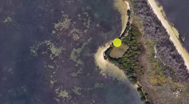
Points are any type of protrusion that sticks out from an area of land.
Points are good because they make great ambush points for predators.
Also, there’s usually some type of depth change around a point.
Leeward vs. Windward
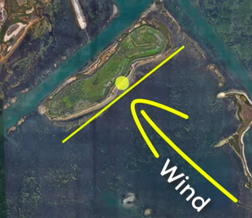
Windward and leeward sides of islands refer to which side the wind is hitting.
In the image above, the wind is hitting the side with the yellow line on it, so that’s the windward side.
The opposite side, the side not getting hit by the wind, is the leeward side.
This is important because depending on the time of the year and the temperature, fish will often prefer one side over the other.
For example, when the water is hot, the fish will likely prefer the windward side because it cools down the water.
When the water is cold, fish will likely prefer the leeward side because the water on that side is warmer because it’s not being cooled by the wind.
Channels
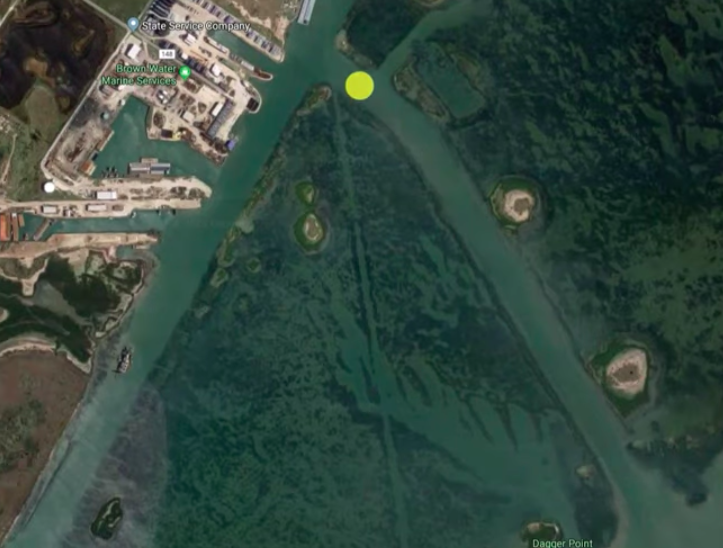
Unlike a cut or a trough, channels are manmade.
They’re usually pretty straight and stick out like a sore thumb.
But like cuts and troughs, these are good areas to catch fish because they provide depth changes and ambush points for predator fish.
Shoals
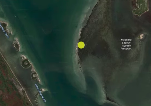
Shoals are shallow sandbars.
They can run along the edge of a flat (like pictured above) or can just be out in the open.
These also provide depth changes and ambush points.
Oyster Bars
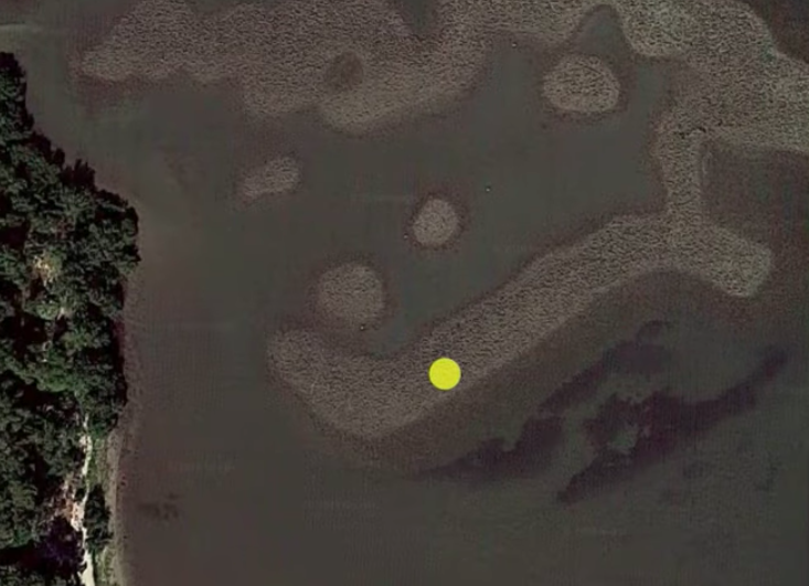
When you’re looking for oyster bars on the map, you’ll be looking for a rocky looking mass with round edges.
Now, a lot of people might get oyster bars confused with sand bars, but sand bars are usually more smooth looking and lighter in color.
Conclusion
Whether you’re fishing for trout in Texas, snook in Florida, or redfish in North Carolina, they all have one thing in common: they like structure.
Now I’ve just shown you how to find many structure elements using online maps, but if you want to catch fish you need to know the right time to fish these areas.
Depending on the weather, tide, season, and many other factors, fish may be at an oyster bar one day, but gone the next.
The key to consistently finding feeding fish is knowing the trends.
And that’s exactly what we show you in the Insider Club.
Plus, you’ll save money with our exclusive discounts, and there are over 10,000 members, so there’s likely someone who fishes in your area that can point you in the right direction or even go out fishing with you.
Click here to learn more about the Insider Club.
Do You Want To Quickly Find New Fishing Spots In Your Area?
Then you’ve got to see this private fishing club!
Here’s what you’ll receive today:
- Weekly fishing reports and TRENDS revealing where the inshore fish are feeding all year long
- Weekly “spot dissection” videos that walk you through all the best spots in certain areas
- Exclusive fishing tips from the PROS you can’t find anywhere else
- Everything you need to start catching fish more consistently (regardless if you fish out of a boat, kayak, or land).
Click here to join today.
Related articles:
Related categories:
STOP WASTING TIME ON THE WATER!
Do what the “SMART ANGLERS” are doing and join the Insider Club.
Here’s what you’ll receive today when you join:
- Weekly fishing reports and TRENDS revealing exactly where you should fish every trip
- Weekly “spot dissection” videos that walk you through all the best spots in your area
- Exclusive fishing tips from the PROS you can’t find anywhere else
- Everything you need to start catching fish more consistently (regardless if you fish out of a boat, kayak, or land).


Having a little trouble navigating the site. How do I find the reports and spots for Southeastern North Carolina. I have places in both Shallotte, North Carolina (my boat is there) and Fernandina Beach, FL.
Hey Hal,
The easiest way is to use the map. You will find it on the drop down menu in the top right of the screen on the community home page. Here is a direct link to it:
https://community.saltstrong.com/RegionalMap.php
Great video. I’ve gotten good at identifying structure around the Indian River Lagoon flats, but I haven’t figured out when the fish are going to be at which spot. Been fishing for 3 months now, mostly on my kayak, and I’ve Gotten skunked a lot. Tony can you suggest some Insider videos I should watch?
Great tips Tony!
Thanks Luke!
I so needed this video! Thanks Tony!
No problem William!
Great info sir! Thank you
No problem Thomas, thank you!