How To Find The GPS Coordinates For Thousands Of Reefs In Your Area (FAST)
- By: Joseph Simonds
- on
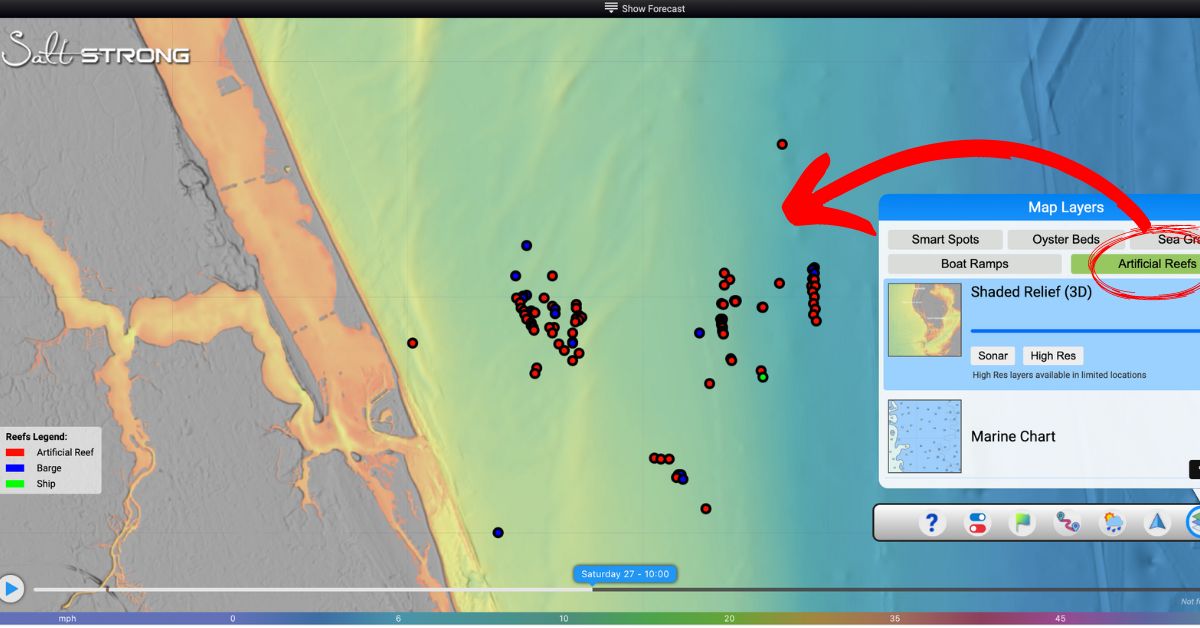
How does gaining access to GPS coordinates for thousands of reefs in your area sound?
Nearshore and offshore reefs and wrecks are hotspots for anglers looking to reel in snapper, grouper, and so much more a few miles from shore.
Smart Fishing Spots is our all-in-one fishing app that provides not only the tides and wind forecasts, but also gives you fishing hotspots in your area on top of high-resolution satellite mapping and much more!!
Just this week, we added ANOTHER feature that gives you instant insight into where the nearshore and offshore reefs are nearest you.
Are you an Insider Member yet?
What are you waiting for?!?!
You can watch the video version of this podcast below (which I highly recommend), listen to the audio version by clicking the play button underneath it, or listen to it on iTunes, Stitcher, or Spotify.
P.S. Don’t forget to subscribe on iTunes, Stitcher, or Spotify and leave us a review!

Find The GPS Coordinates For Thousands Of Reefs In Your Area [PODCAST]
Note: Don’t forget to subscribe to the Salt Strong podcast on iTunes, Stitcher, or Spotify and leave us a review!

Related Podcasts:
- NEW 4K SATELLITE MAP MAKES GOOGLE MAPS LOOK SILLY!
- NEW TOOL ACCURATELY PREDICTS WHERE TO FIND REDFISH & TROUT EVERYDAY!
Here is a timestamped version of this episode:
- 2:00 – Get Reef GPS Coordinates FAST
- 4:10 – Walk-Through of “Artificial Reefs” Layer
- 5:52 – High-Resolution Satellite Imagery
- 9:06 – Offshore Fishing with Artificial Lures and Smart Fishing Spots
- 10:50 – How To Export GPS Coordinates to your Depth Finder
- 14:17 – EXAMPLE: Planning A Trip
- 15:53 – Total Artificial Reefs Added
- 16:05 – Joe’s Trip to the Bahamas
- 17:48 – Panhandle Reefs
- 19:55 – 4K Satellite View
- 21:05 – Google Maps VS. Smart Fishing Spots
- 22:12 – Map Layers Overview
- 22:40 – Smart Spots
- 25:10 – Oyster Bars and Seagrass
Find The GPS Coordinates For Thousands Of Reefs In Your Area [VIDEO]

Conclusion
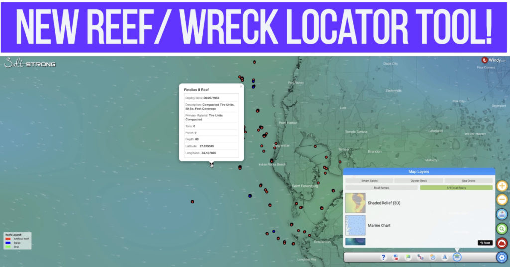
Is there anything better to an offshore angler than the exact GPS locations of underwater reefs and wrecks that are holding a ton of fish?
We’re here to help you catch MORE fish in LESS time.
This is just the beginning of Smart Fishing Spots!!
Do you have any additional questions about the Smart Fishing Spots App?
Let us know what you think of the new features down in the comments!!
Has Smart Fishing Spots helped you catch more fish?
Share your stories in the Community!!
If you know someone who wants to learn more about Smart Fishing Spots, please TAG or SHARE this with them!
Oh, and if you Join the Insider Club TODAY, Smart Fishing Spots is absolutely FREE! Click here to join us in the Insider Club!
Related Articles:
Related categories:
STOP WASTING TIME ON THE WATER!
Do what the “SMART ANGLERS” are doing and join the Insider Club.
Here’s what you’ll receive today when you join:
- Weekly fishing reports and TRENDS revealing exactly where you should fish every trip
- Weekly “spot dissection” videos that walk you through all the best spots in your area
- Exclusive fishing tips from the PROS you can’t find anywhere else
- Everything you need to start catching fish more consistently (regardless if you fish out of a boat, kayak, or land).


Can I use phone
Yes sir. We have all of these reefs programmed into Smart Fishing Spots app
How can I find out the deed reef
Nick,
Any reason I can not see the open spot on reefs off NC coast? I can not click on them on either phone or computer.
As a member who lives outside the south east (up here in MD), it is very hard to tell what parts of the Smart Fishing spots app are available in my region. Would it be possible for you to post a coverage map for the various layers of the app? For example: i am not able to find may smart spots in Maryland and also it appears that there are no ramps listed in Maryland. If I knew those layers don’t yet apply to my region, I wouldn’t worry about it. I understand not all areas can be covered immediately, so I am not being critical of any potential lack of coverage in my area. It is more that I would know what to look for and expect if I could quickly and easily see a coverage map for the different layers.