This Map Shows Which Boat Ramps Are Closed & Which Are Open
- By: Tony Acevedo
- on
- Found In: Fishing Tips, Boating Tips, Weekly Newsletter: 4-5-20
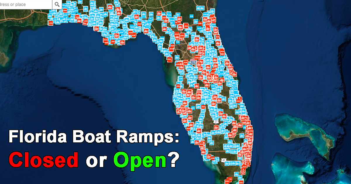
There’s a lot that’s unknown right now, but thanks to the FWC, it’s easy to tell whether your favorite boat ramp is closed or not.
They’ve put together this interactive map that shows information about each boat ramp in Florida, including which ones are closed and which ones are open.
Check out this quick video I put together showing how to use this map below.
Florida Boat Ramp Closures [VIDEO]

You can see this map here:
http://atoll.floridamarine.org/dle_gis/javascript/boat_ramp_status/
FWC Enforcement division is doing an amazing job of keeping this map updated as frequently as possible, and it’s definitely making it easier for us anglers to stay in the know.
Do you know of any other states that have similar tools?
Let me know in the comments below!
And if you’re an Insider member, you can also check out the “Water Access” topic in the community where we’re all keeping each other up to date on boat ramp closures.
If you’re not an Insider, you can click here to join us and +12,000 other members in the Insider Club.
P.S. Please SHARE this with your fishing buddies!
Stop Wasting Time On The Water!
Do what the “SMART ANGLERS” are doing and join the Insider Club.
Here’s what you’ll receive today when you join:
- Weekly fishing reports and TRENDS revealing exactly where you should fish ever trip
- Weekly “spot dissection” videos that walk you through all the best spots in your area
- Exclusive fishing tips from the PROS you can’t find anywhere else
- Everything you need to start catching fish more consistently (regardless if you fish out of a boat, kayak, or land).
Click here to join today.
Related articles:
Related categories:
STOP WASTING TIME ON THE WATER!
Do what the “SMART ANGLERS” are doing and join the Insider Club.
Here’s what you’ll receive today when you join:
- Weekly fishing reports and TRENDS revealing exactly where you should fish ever trip
- Weekly “spot dissection” videos that walk you through all the best spots in your area
- Exclusive fishing tips from the PROS you can’t find anywhere else
- Everything you need to start catching fish more consistently (regardless if you fish out of a boat, kayak, or land).
STOP WASTING TIME ON THE WATER!
Do what the “SMART ANGLERS” are doing and join the Insider Club.
Here’s what you’ll receive today when you join:
- Weekly fishing reports and TRENDS revealing exactly where you should fish every trip
- Weekly “spot dissection” videos that walk you through all the best spots in your area
- Exclusive fishing tips from the PROS you can’t find anywhere else
- Everything you need to start catching fish more consistently (regardless if you fish out of a boat, kayak, or land).



It would be appropriate to update this map-especially after a hurricane. Please help local commerce by doing this!
This map is updated by the state and is currently up to date if you click the link for it up above.
Thanks guys. I found I could add the FWC boat ramp locater site to my “Color Note” app on my phone for easy quick access.
No problem Gordon!
This map appears to be over a month old. I have been off from work for over a month and yet my truck is still shown parked in my parking space at work instead of at my residence.
Hey Bill,
The map itself can be out dated (the imagery), but the status of ramps is the main focus which can be updated regularly by FWC.
Then why have the site in red and green?
Come on & earn it
Not sure what you’re referring to there, but the boat ramp map is maintained by the state (FWC) and is up to date.
This is a great resource! Update: Wekiva island and King’s Landing are closed now
Thank you for the update Meghan!
Is there a boat ramp open in Palmetto
Thanks guys this was great
No problem Larry!
WTH! They’ve already taken away most everything we can do, now our freedom! I feel angry that we are being held prisoners.
They can close ramps but they can’t close fishing
It says the Edgewater ramp and Kennedy Point Park slightly off SR 50 and US 1 is open. Last I knew those two ramps were closed.
Do to hurricane Irma damage!
Thanks so much for this Tony! This is going to help a lot of folks out!
No problem Wyatt!